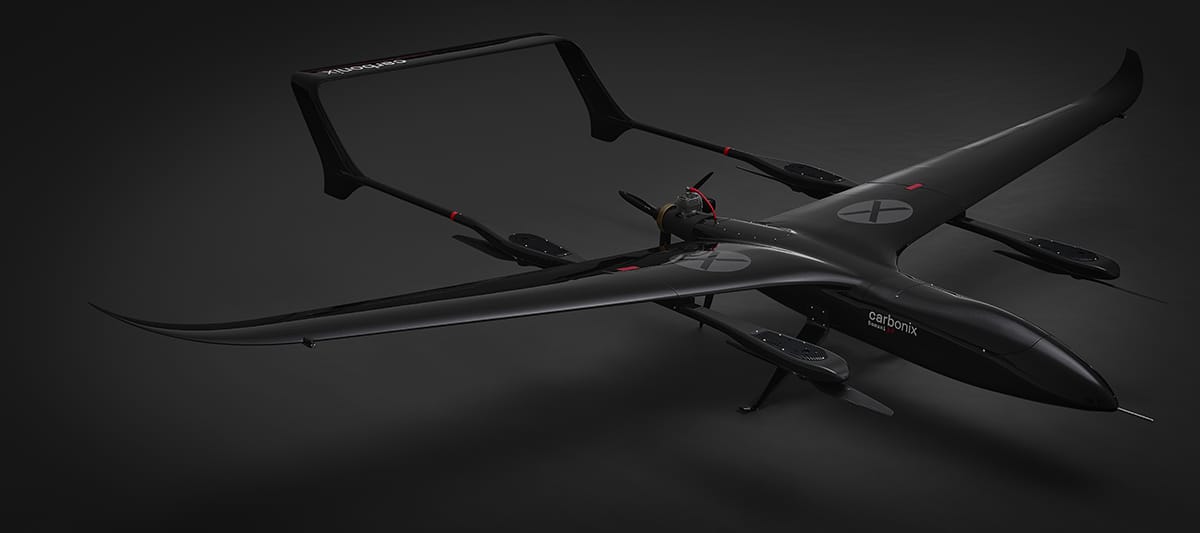
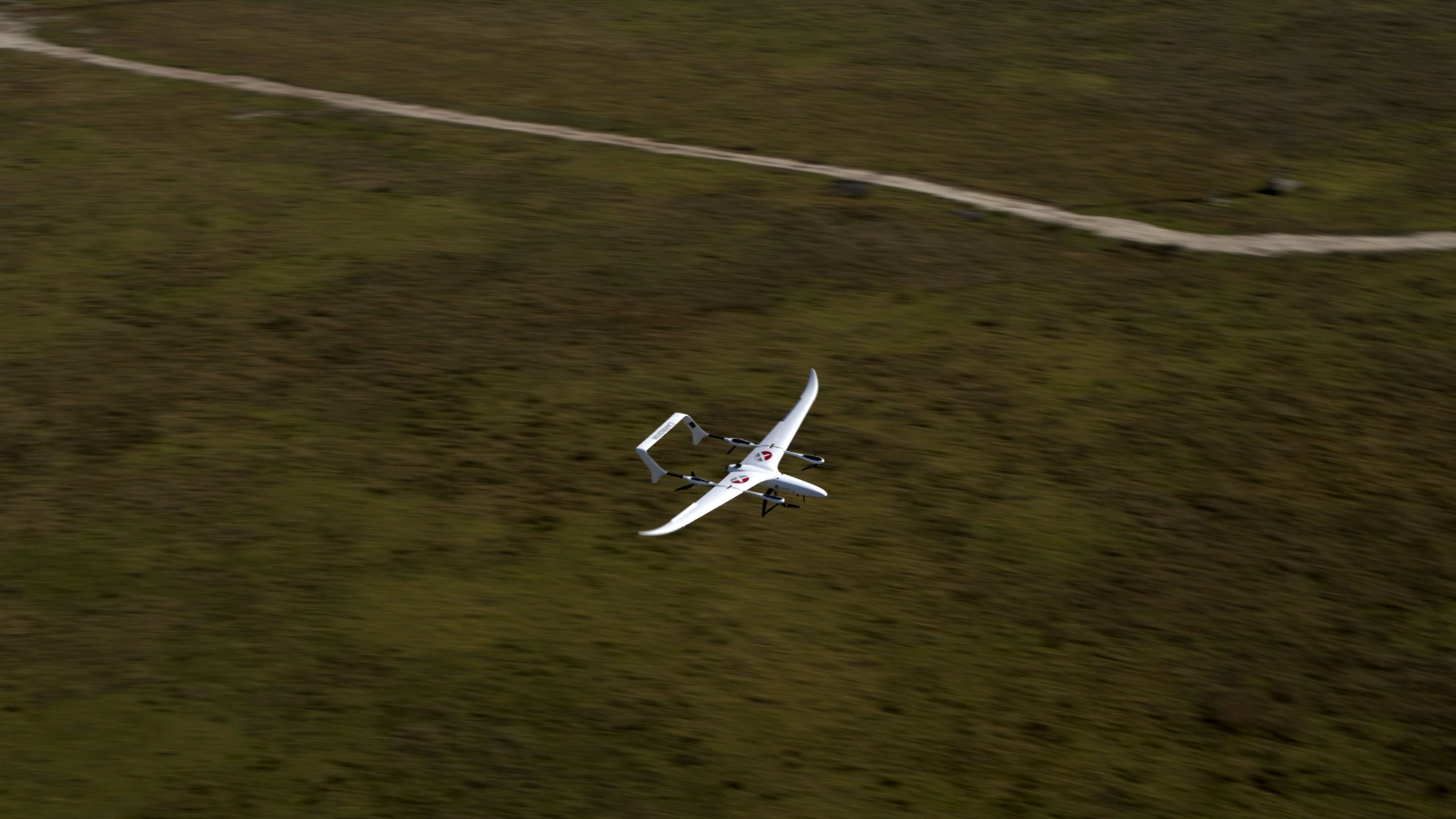
Long-Range Survey Drone

good-design-award_best-in-class_rgb_blk_logo
  • 2023

  • Engineering

Commissioned By:

Carbonix

Designed In:

Australia

A Remotely Piloted Aircraft System for long-range surveying and surveillance to gather critical aerial data safely at scale.
Carbonix has created an elegant solution for acquiring detailed LiDAR scans, photography, and video of infrastructure over long distances and large areas.


view website
view facebook

  • CHALLENGE
  • SOLUTION
  • IMPACT
  • MORE
  • Large-scale infrastructure (electricity transmission lines, pipelines, railways, mines, farms) requires regular inspections to identify faults, plan maintenance, and ensure serviceability. Inspections are currently done using crewed aircraft (helicopters and small fixed-wing). This is expensive, dangerous, and contributes significant carbon emissions. Drones have been proposed as an alternative but, so far, no commercially viable uncrewed aircraft had the range, practicality, and level of assurance to be a realistic challenger to incumbent crewed aircraft. Specifically, multirotor drones lack the range, and fixed-wing drones require impractical infrastructure for launch and retrieval (runways or catapults for launch and arrestor nets or parachutes for landing).

  • Combining an efficient fixed-wing airframe with Vertical Thake-Off and Landing (VTOL) capability allows operators to launch and retrieve from unprepared sites whilst enjoying the reach of multi-hour flight times. To achieve such efficiency, Carbonix developed sophisticated design tools and advanced materials - resulting in a lightweight strong airframe with exceptional power-to-weight and lift-to-drag. Enabling practical daily use required an intuitive user-interface, sophisticated automation logic, and robust long-range communications (switching between mesh radio, cellular, and satellite link). Combining the equipment necessary to achieve these capabilities into a compact streamlined package required a multidisciplinary coordinated innovative approach backed by thorough and extensive testing.

  • Making data capture accessible at scale. Carbonix made it commercially viable to fly regular data-capture missions over distances that previously required crewed aircraft. Asset operators can now regularly gain detailed information affordably and safely (weekly flights covering 500+ Km, achieving sub-10mm resolution). Cutting carbon emissions by 98%. Carbonix drones carbon footprint is 2% of the crewed aircraft they replace. Downstream savings include fewer 'false positives' resulting in fewer unnecessary deployments of personnel on the ground. All with improved safety due to the aircraft operator remaining on the ground. Ground impact is also reduced because the noise footprint is virtually nil.

  • The system was designed from the outset with certification in mind. Part of the development process was working closely with regulators to define relevant categories and assurance strategies. As a result, Carbonix was able to obtain authorisation to operate Beyond Visual Line of Sight (BVLOS). Meaning the drone can fly without direct visual supervision. Thus it can be operated remotely, further increasing practicality and flexibility. Though the main focus is infrastructure (electricity transmission lines, pipelines, railways, mines, farms), customers have used Carbonix systems for military ISR (Intelligence, Surveillance, Recognisance), for habitat preservation (identifying species in national parks), and bushfire prevention (early detection). This is testament to the robustness and flexibility of the system that combines efficient aerodynamics, lightweight structures, robust electronics, advanced communications, intuitive user interface, and well thought-out automation. Ease of operation was a key design criteria, reflected in the VTOL capability, modularity (allowing the system to quickly pack into a box that fits in a van or ute), long service intervals, and provision for remote updates.