Emesent Hovermap

good-design-award_winner_rgb_blk_logo
  • 2019

  • Product
    Commercial and Industrial

Designed By:

  • Design + Industry

Commissioned By:

Emesent

Designed In:

Australia

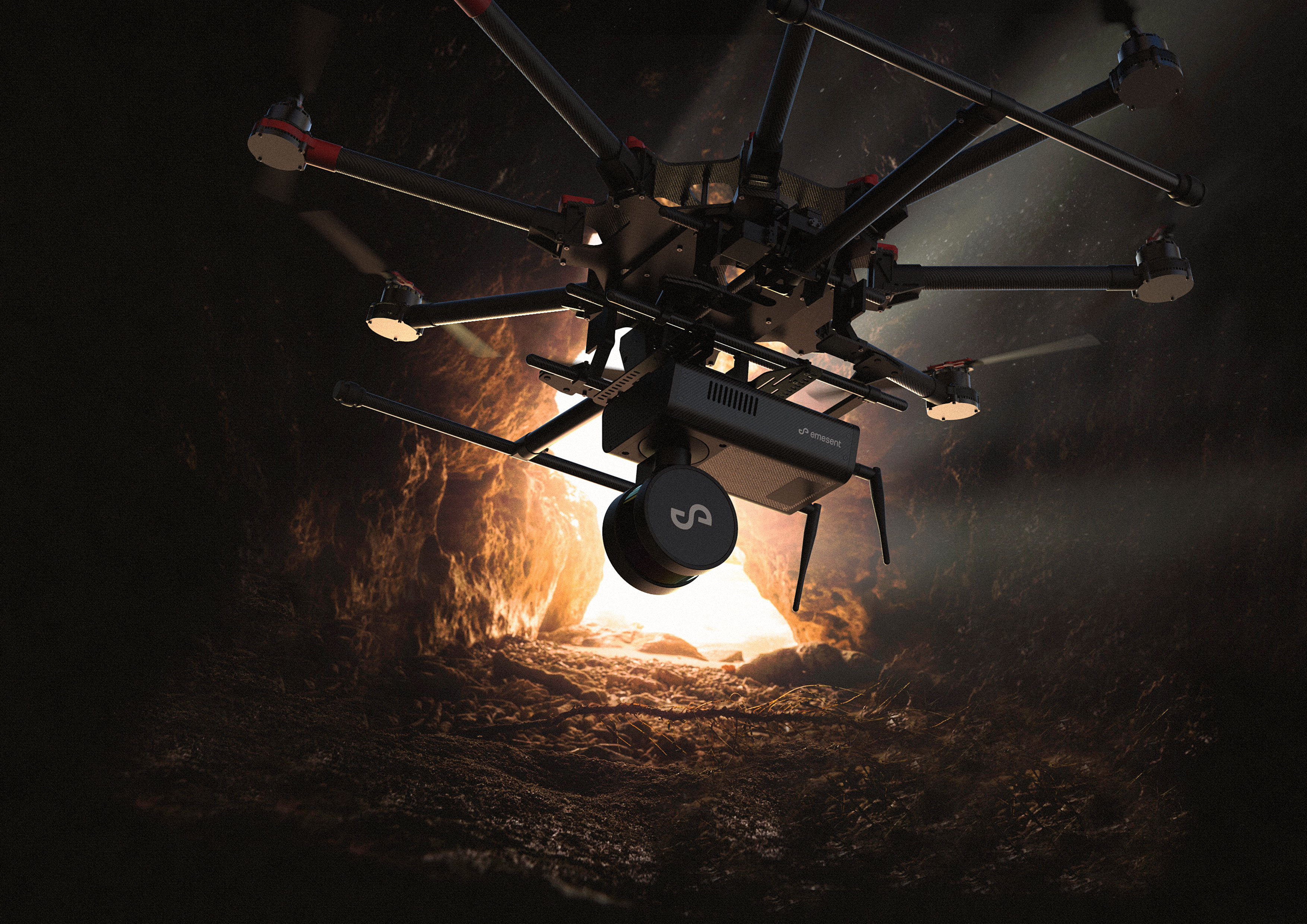
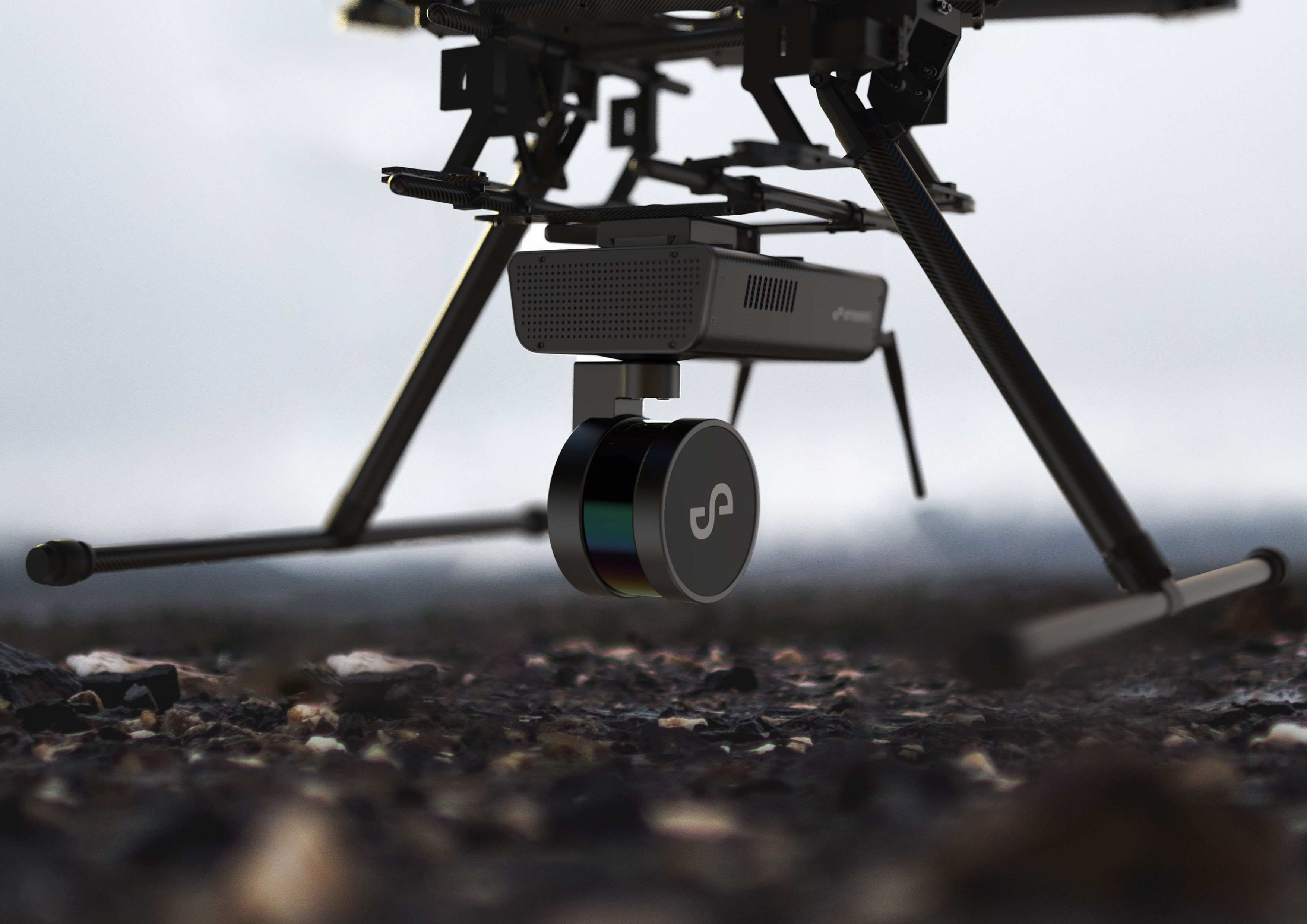
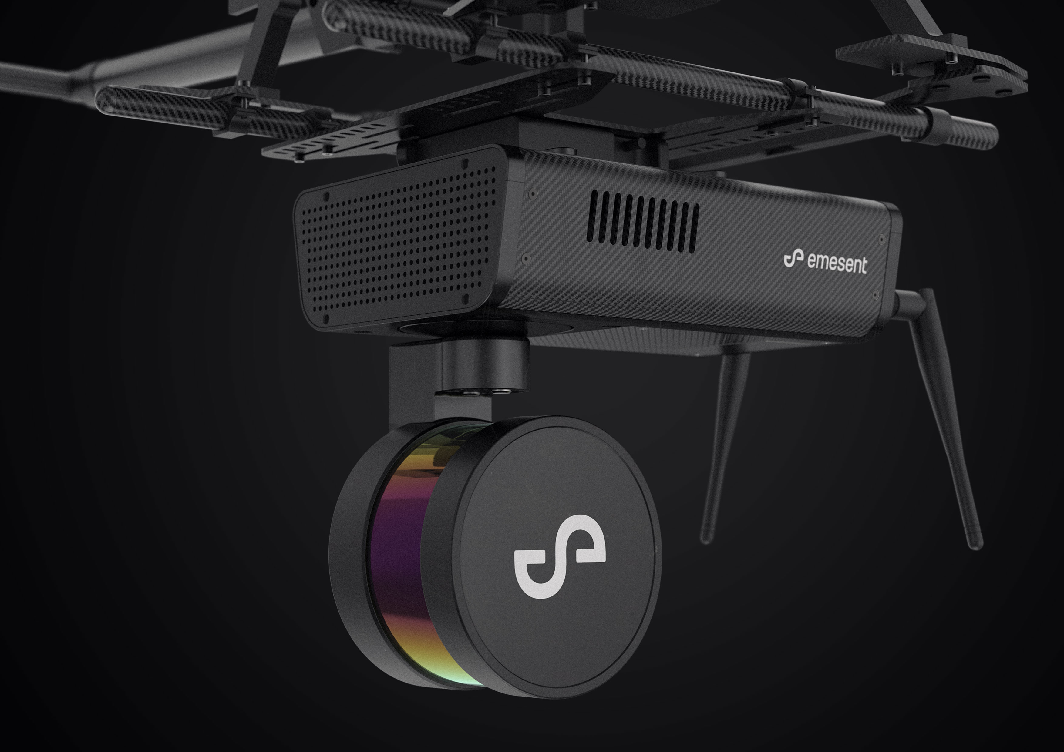
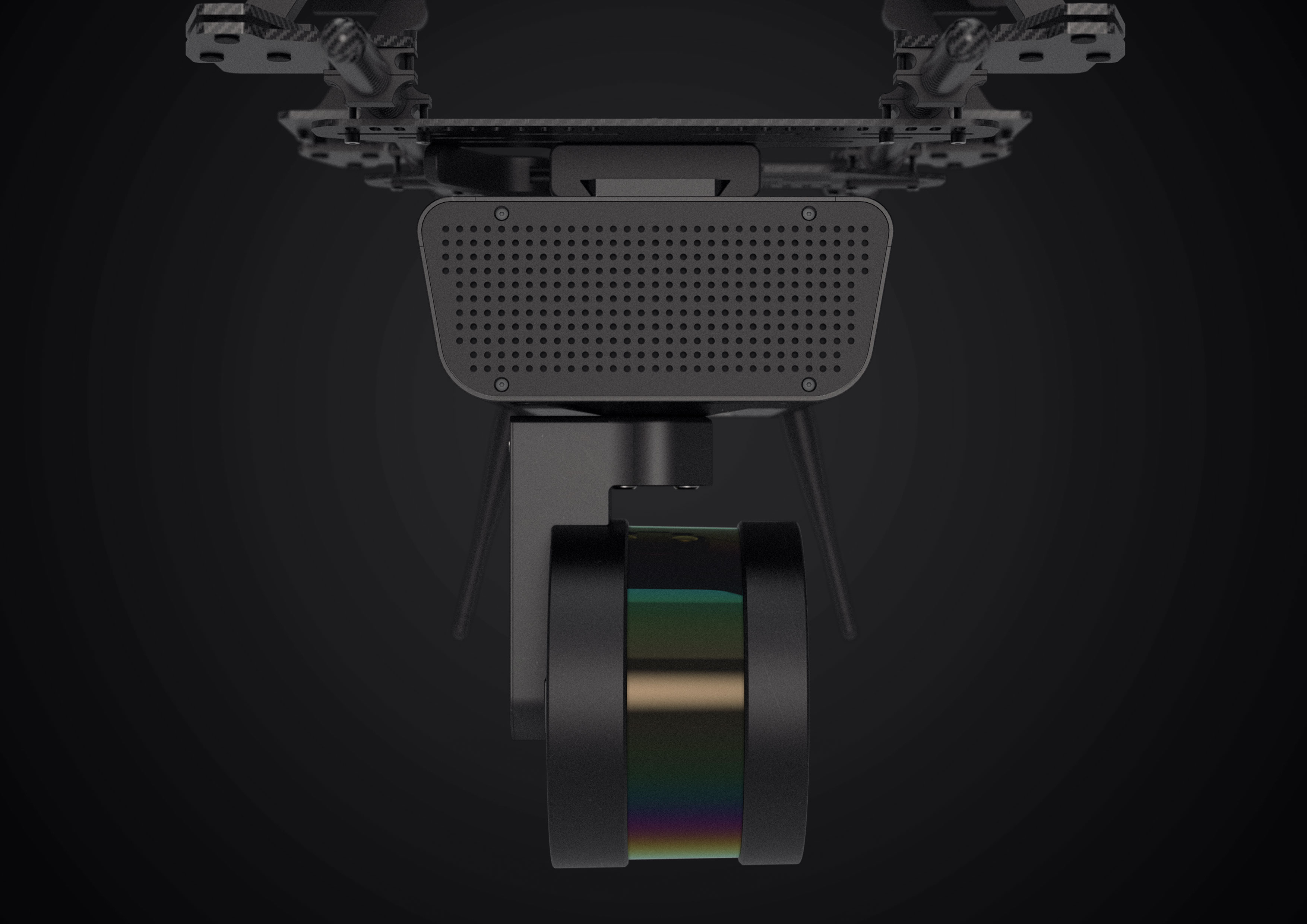
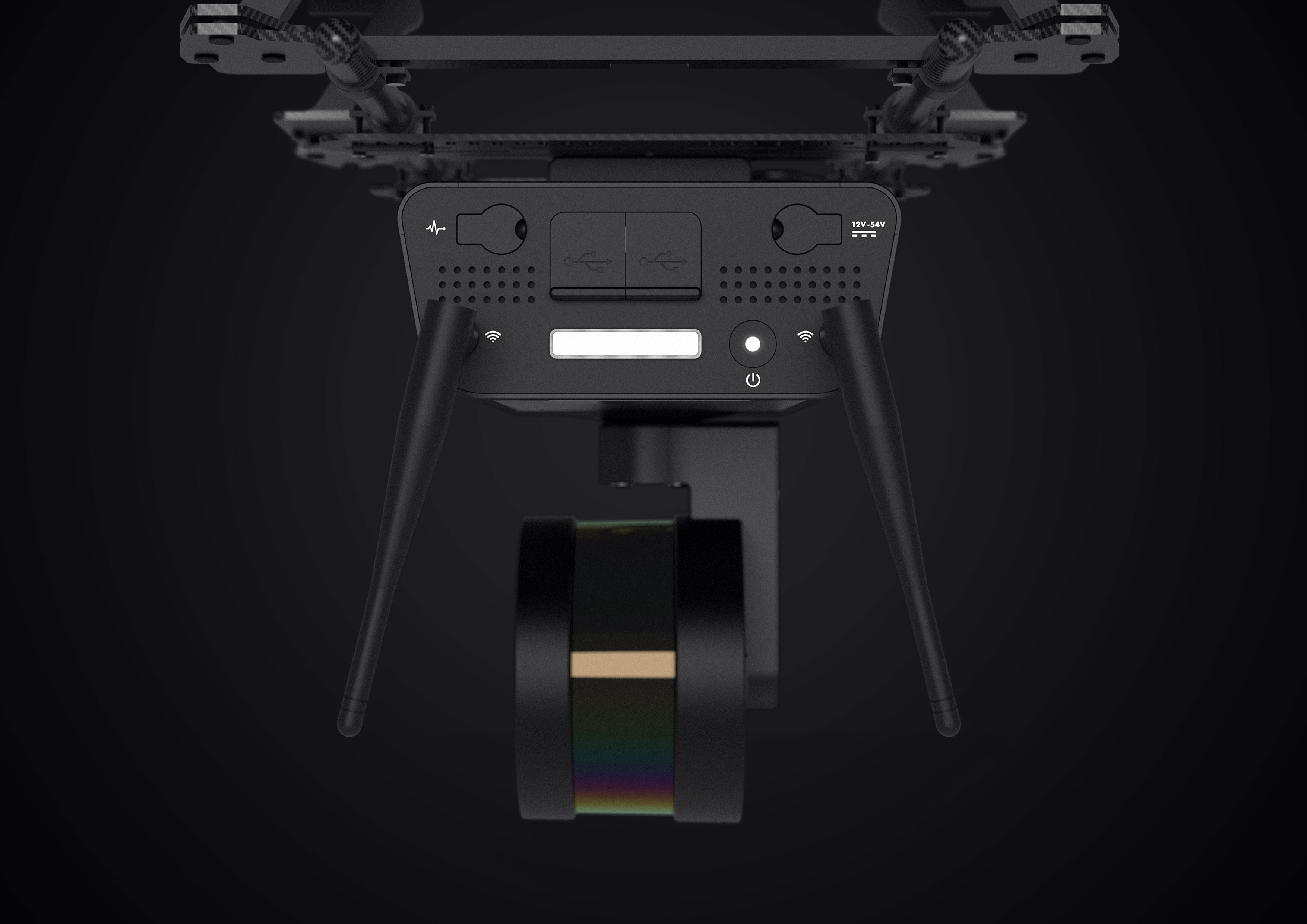
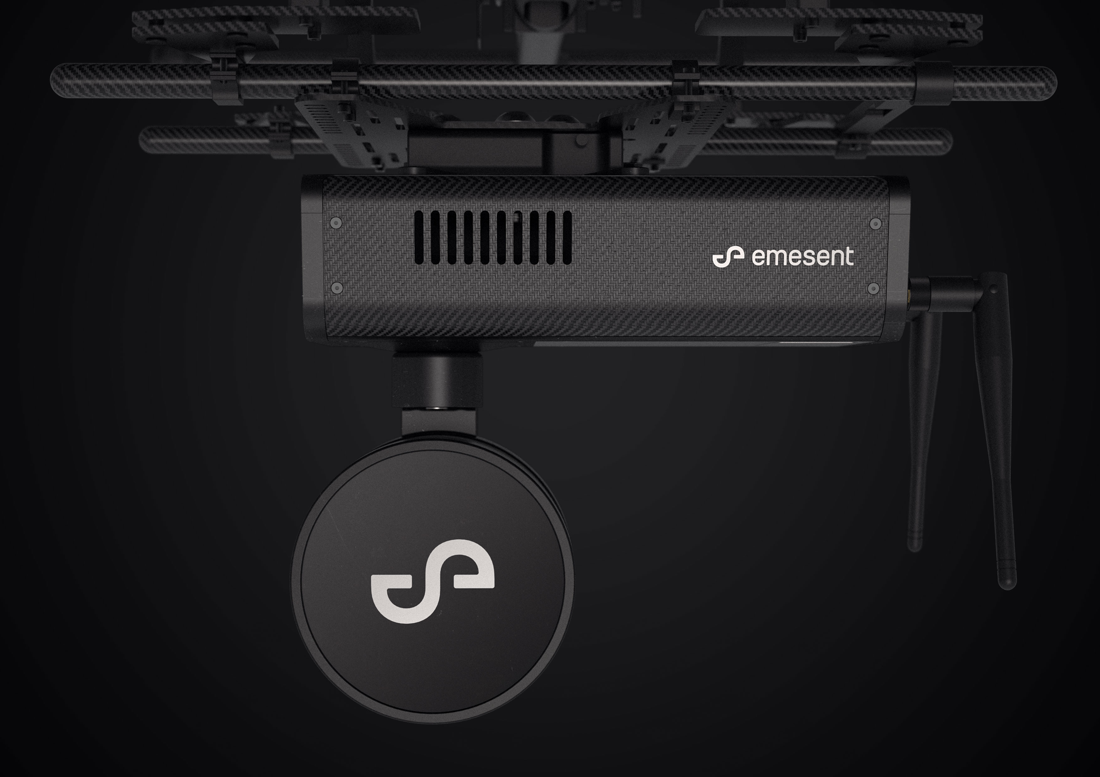
Hovermap is a LiDAR mapping and autonomy payload from Australian start-up Emesent. Industrial drones equipped with Hovermap can be deployed in hazardous and challenging GPS-denied environments, collecting 3D mapping data where it was previously impossible. Bridges, towers and mines are some of the locations that can now be mapped safely.


view website
view facebook
Buy online

  • CHALLENGE
  • SOLUTION
  • IMPACT
  • MORE
  • The challenge was to design a payload for industrial drones that included a LiDAR (Light Detection and Ranging) sensor to allow autonomous flight in GPS-denied environments and 3D mapping using SLAM (Simultaneous Localisation And Mapping). The payload had to be extremely lightweight (less than 2kg) and yet robust enough to withstand the demands of challenging environments, such as underground mines. The payload needed to be quick to deploy (ideally in less than one minute) and easy to operate. Key inflight requirements to be met included weight, balance, thermal management of internal components and mechanical precision.

  • Drones equipped with Hovermap are capable of collision avoidance, GPS-denied flight, advanced autonomy and SLAM-based LiDAR mapping. Hovermap uses a machined aircraft-grade aluminium frame combined with carbon fibre composite panelling to provide a strong, lightweight enclosure capable of remaining stable in flight as the LiDAR module spins. External dimensions were optimised so Hovermap can be fitted to a wide range of existing industrial drones. Thermal management of internal components is handled by an air-filtering and exhaust manifold system. A quick-fit system was developed to enable rapid deployment while a highly-legible user interface was designed to optimise usability in all locations.

  • Hovermap provides an unprecedented level of up-close access to facilities and assets for the purpose of inspection and mapping, gathering 3D and other data which was previously impossible to collect. The insights gained from this precise 3D mapping can identify safety risks and increase the lifespan of commercial assets by allowing more thorough and targeted maintenance. The ability to fly autonomously in hazardous and challenging GPS-denied environments allows users to safely monitor environments from a distance. Underground mines, tunnels, bridges, telecom and transmission towers and many more can now be mapped and inspected safely, without putting humans at risk.

  • • Omni-directional LiDAR-based collision avoidance and autonomy. • GPS-denied flight allows flying indoors, underground or under bridges. • SLAM-based 3D LiDAR mapping allows mapping even when GPS is unavailable • Factory configurable in both a horizontal variant, for underground and vertical asset inspection, and vertical variant for mapping horizontal assets and open areas. • Capable of acquiring 300,000 point-cloud data points per second. • Point cloud data files are easily uploaded and integrated using Hovermap’s propriety UI and software platform.