Caulfield to Dandenong Level Crossing Removal Project

good-design-award_gold-winner_rgb_blk_logo
  • 2019

  • Architectural
    Place Design

Designed In:

Australia

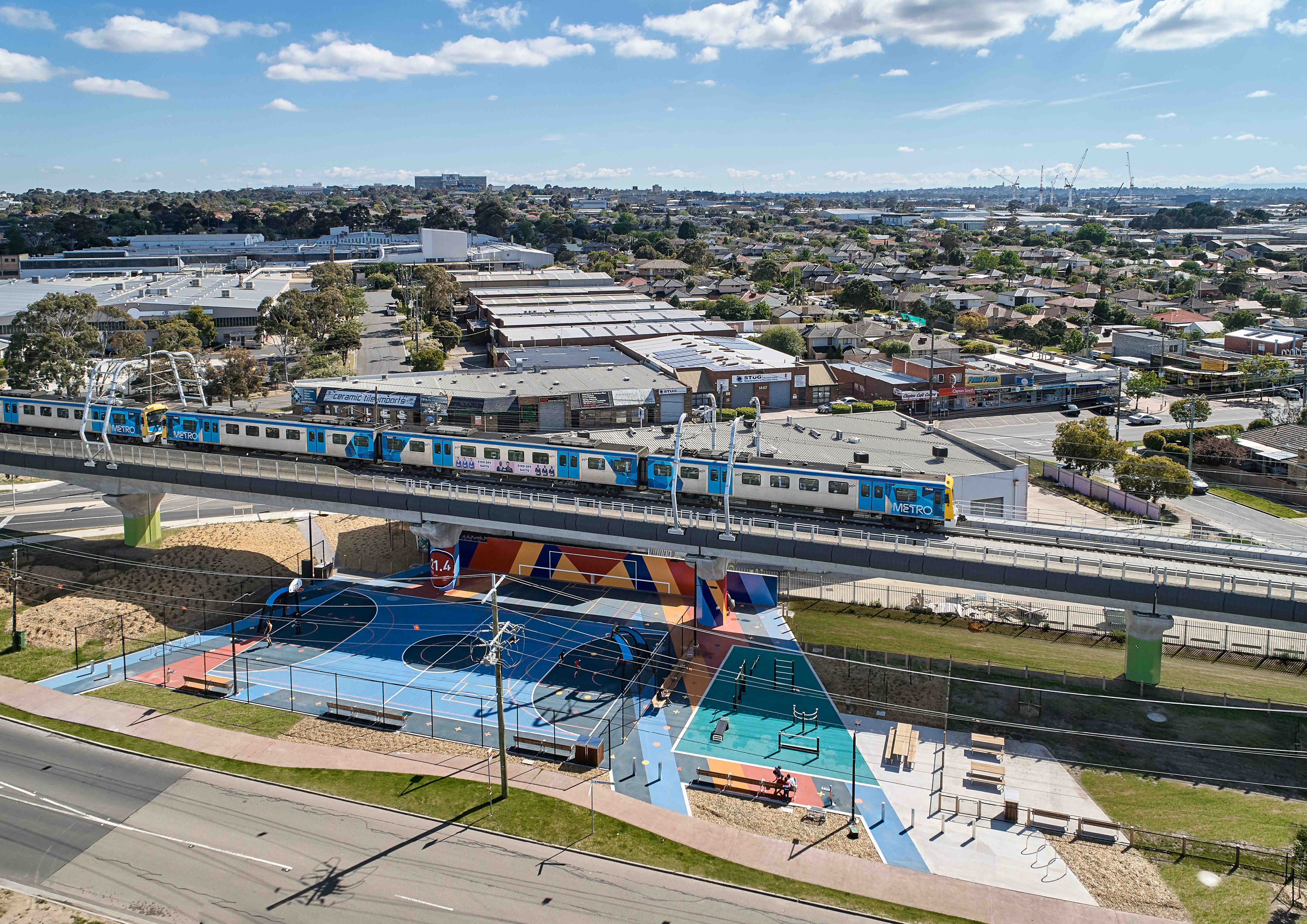
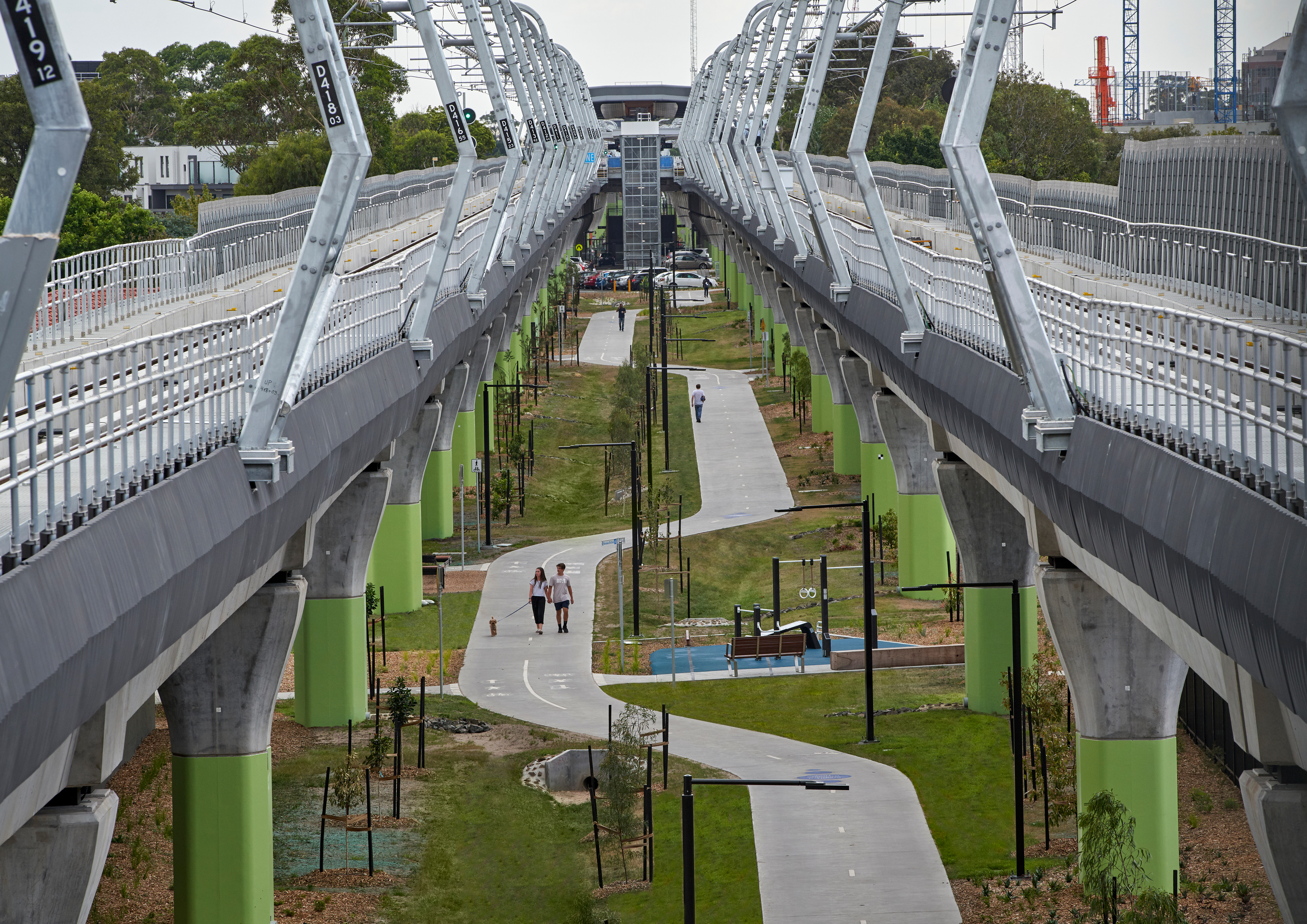
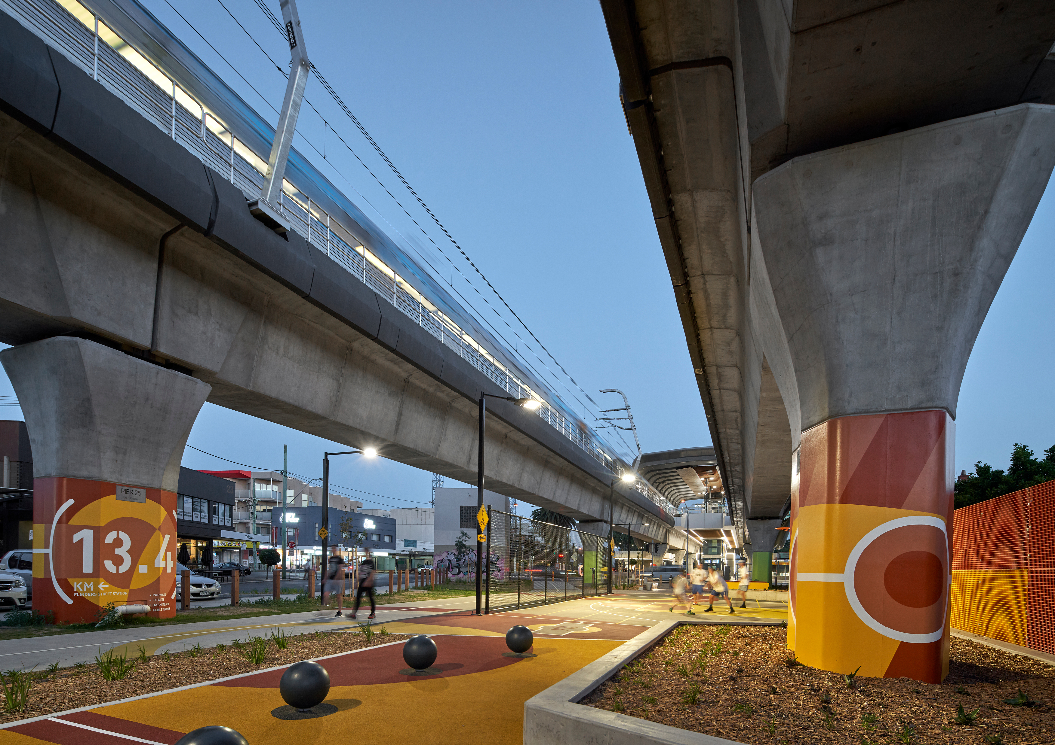
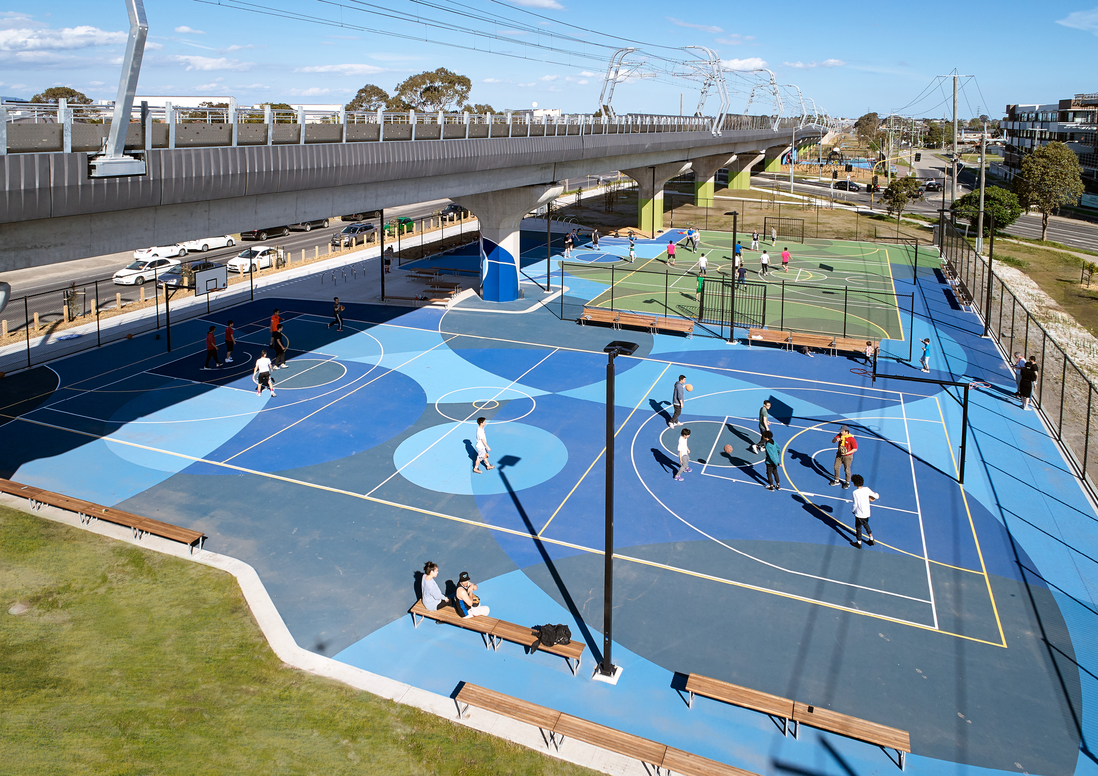
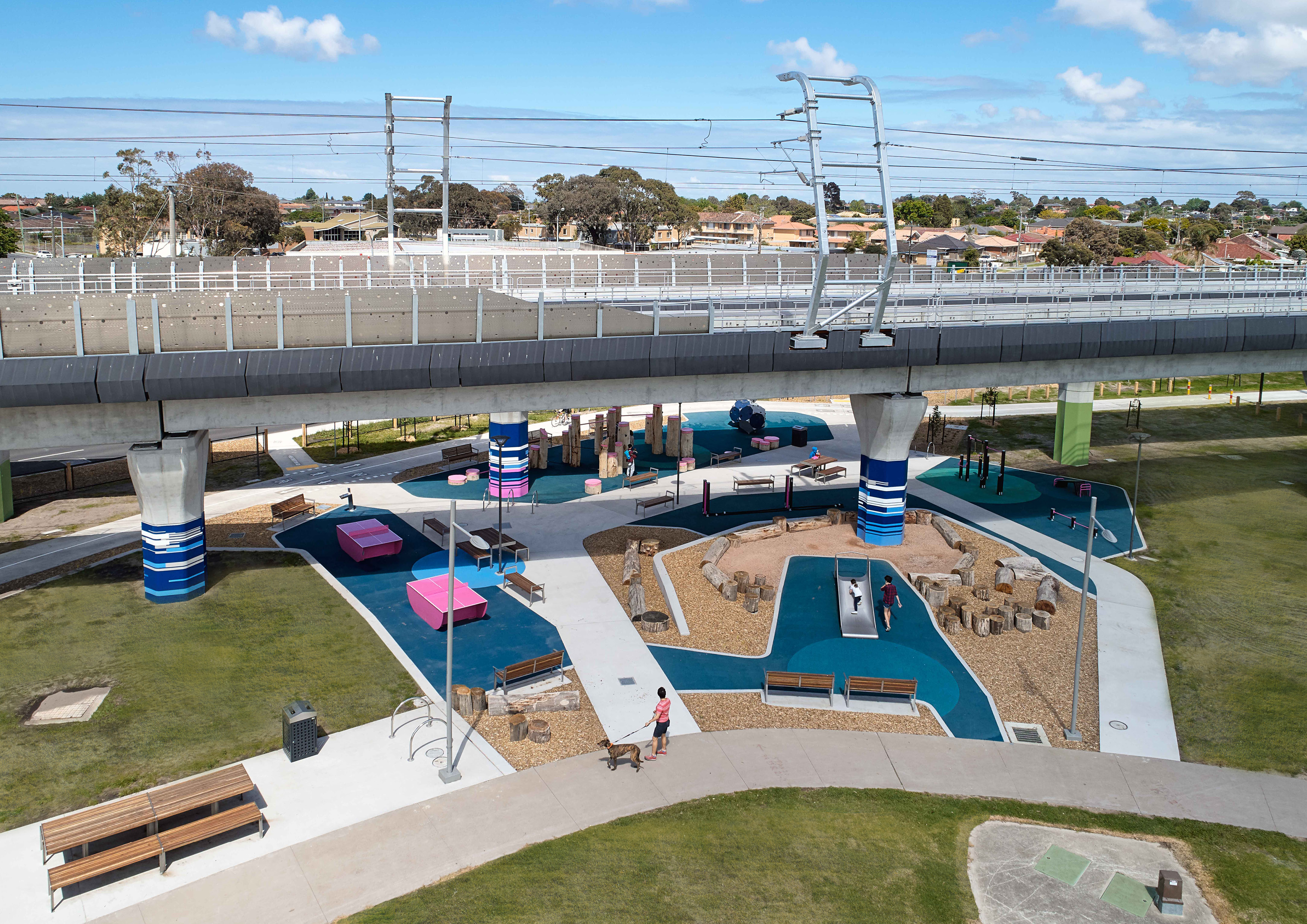
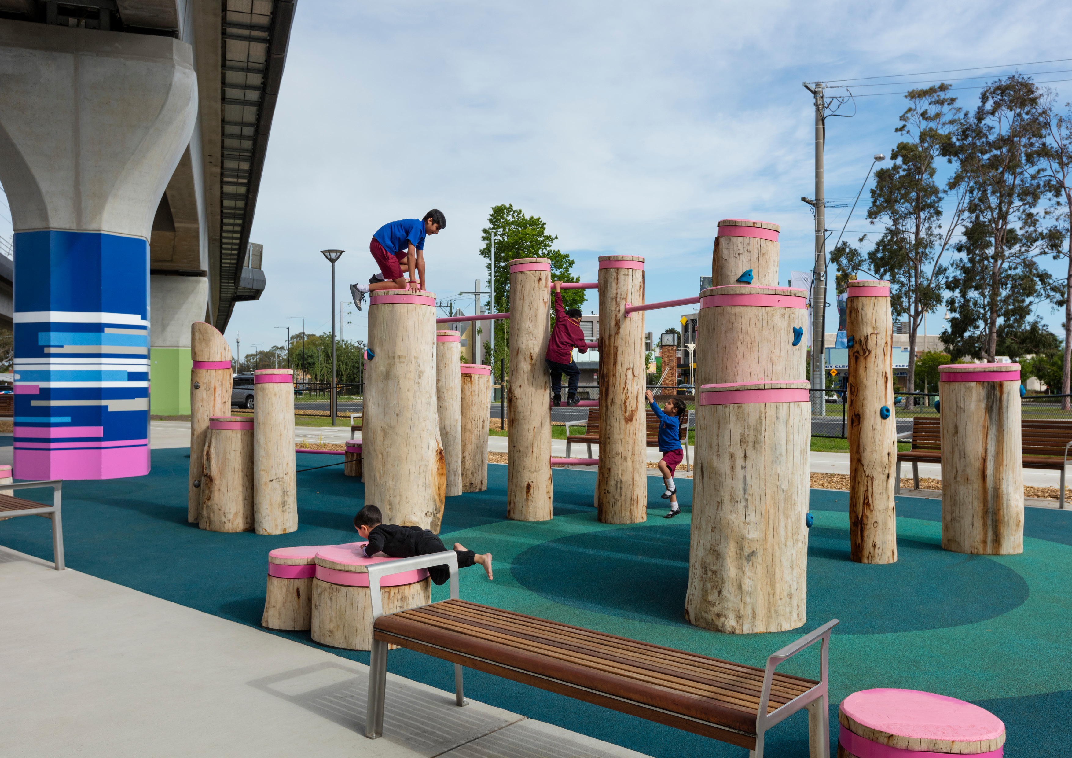
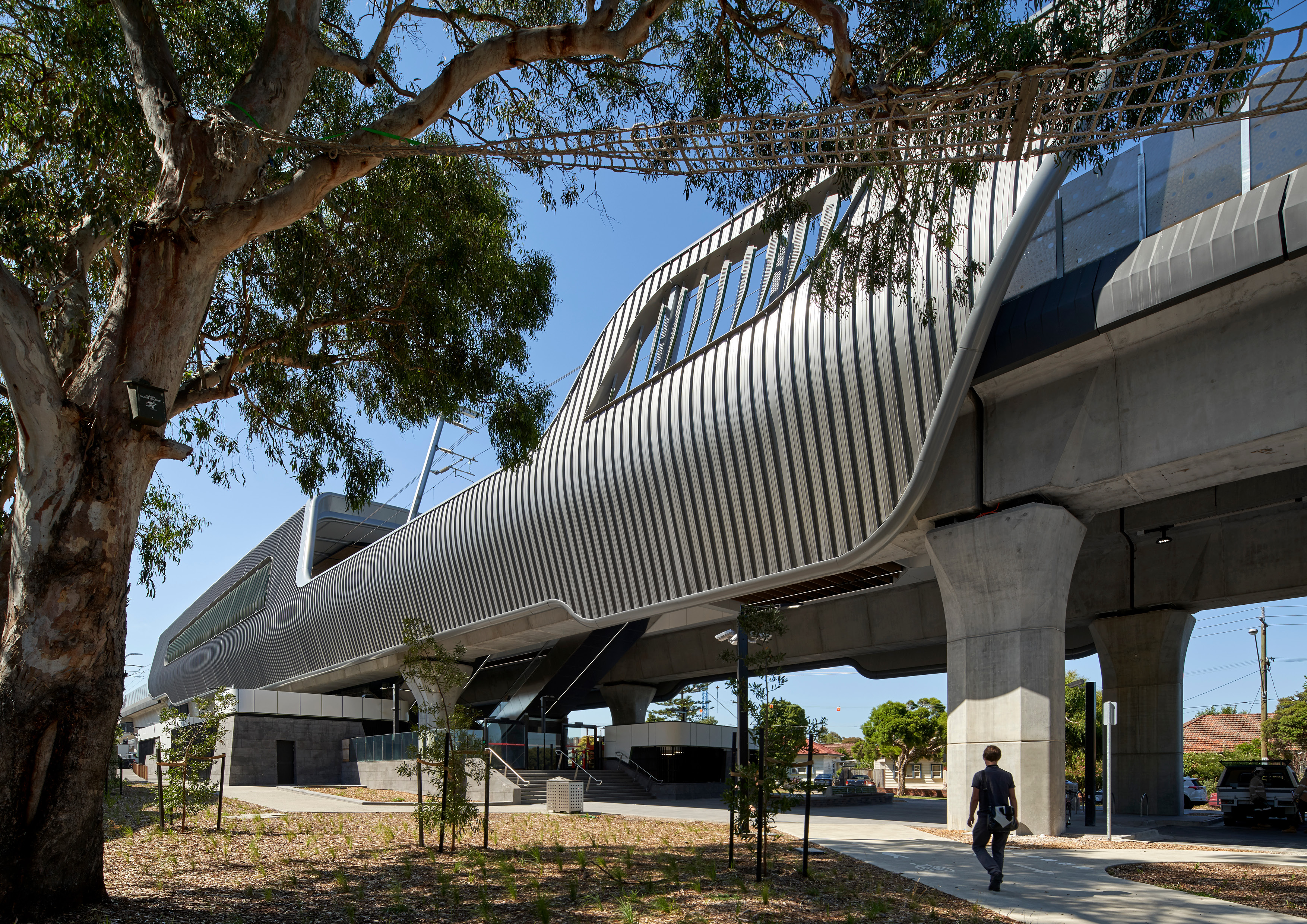
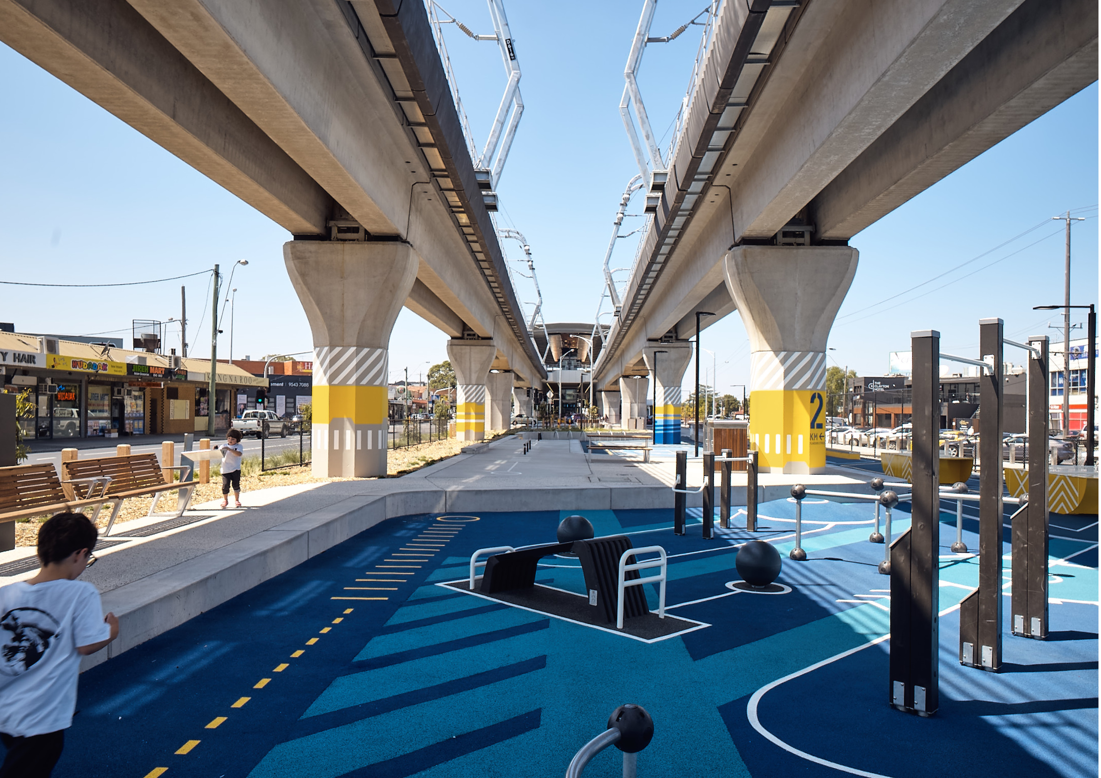
Melbourne’s busiest rail corridor has been unlocked through the elevation of three lengths of the Pakenham Line between Caulfield and Dandenong. Colloquially, ‘The Underline’ highlights the true city shaping power of integrated transport and land use planning, demonstrating how rail corridors can be transformed into vital public recreational space.


view facebook
view twitter

  • CHALLENGE
  • SOLUTION
  • IMPACT
  • MORE
  • The project is comprised of three linear park sections traversing three distinct communities across the suburbs of Carnegie, Murrumbeena, Hughesdale, Clayton, and Noble Park. The design challenge lay in respecting the unique character of each suburban area across a connected, engaging and highly activated public space beneath the elevated rail. This included consideration of constraints, consisting of multiple underground services, reduced rainfall and light, and restrictions on tree height. The project demanded a reimagining of what rail infrastructure looks like and how it functions – to depart from the old standards and approaches and develop new, more sympathetic responses.

  • The project exceeded the brief of removing 9 level crossings and building 5 new stations to create highly effective public space surrounding the stations and within the newly created linear open space. Through collaborative urban design and planning, the project delivered 22.5ha of new open space which is home to 17km of pedestrian and cyclist paths. The linear parks contain numerous multi-generational, multiuse activation spaces which work with the constraints and urbanity of the elevated structure. Extensive community and council consultation was undertaken to identify the current and future needs to ensure the project contributed back to local communities.

  • The design delivered significant public benefit in improved spatial and social connections via new active transport paths and creation of new public green space. Despite not being the primary driver behind the project, it is here where the greatest legacy of the Underline project lies. Beyond urban renewal and the provision of new community spaces, the project has established connections between previously disconnected communities, shopping areas, parks, transport hubs, health services, recreation and community facilities. This elevation has renewed permeability of place, with the community immediately embracing the new spaces with constant daily use by pedestrians, cyclists and residents.

  • Moving beyond lip service to a genuine willingness to name and face challenges, the project team embraced the often-difficult dialogue associated with elevated rail, to emerge with public benefit realised. The project required thinking that grasped the big picture and which was considerate of the complex interrelationships between the range of factors underlying the challenge. Key Features include: • 5 new stations and associated forecourts at Carnegie, Murrumbeena, Hughesdale, Clayton and Noble Park (Station Architecture by Cox Architects) • 1 new civic square (Noble Park) • 5 large scale activation/sport/multi-generational spaces (Carnegie, Clayton, East Clayton, Centre Road, Ross Reserve) • 3 linear parks and shared use path • Multiple small community nodes (dog park, fitness stations, picnic, heritage interpretation, RSL Memorial) • Integrated water management throughout linear parks • The Djerring Trail, a new 17km shared walking and cycling trail ASPECT Studios were the lead wayfinding and interpretation consultant, collaborating with Double-A Communications for activation node graphics, in addition to collaborating with Cox Architecture on the urban design and John Rayner for horticultural design.